.png)


Bolsover Boundary Walk (Day 1) - Cancelled
Type:Walking Event
Riverside Way
Bolsover
Derbyshire
S44 6GA
Call direct on:
Tel01246 345777


About
Unfortunately due to unforeseen circumstances this walk has been cancelled.
A walk, keeping as much as possible, to the Bolsover District Boundary line.
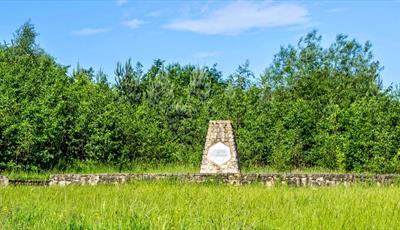
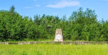
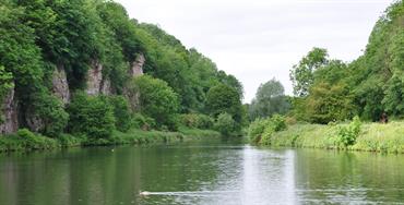
Taking in the most northerly, southerly and highest points together with some places of interest such as Creswell Crags, Pleasley Pit, Pleasley Vale Mills, Hardwick, Pinxton Wharf and the Carr Vale and Peter Fidler Nature Reserve.
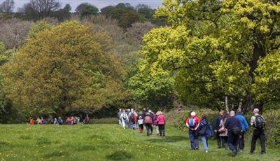
Using as many footpaths and trails as possible, although there will be some road walking, to circumnavigate the district of Bolsover along the boundary line this walk will take place over three days. You can book on all three, or just one or two of these day walks.
Day 1 - Please be aware that this is a linear walk, starting at Peter Fidler Nature Reserve and ending at Cresswell Crags.
Booking essential
Find us on whatthreewords - (start) jungle.tailwind.gourmet (finish) remotest.recoup.fixture
Grid reference - (start) SK 46113 70610 (finish) SK 53944 74413
This is a linear walk
6-10 stiles
Organised by Bolsover District Council
Guide Prices
Admission free. Booking essential. A mini bus shuttle will be offered and a donation to cover running costs will be asked for.
Facilities
Parking
- Free Parking - Parking at Cresswell Crags (finish point) is £4 for up to 3 hours
Property Facilities
- Public toilets - Toilets available at some point on route
Routes
- Accessibility of route - Strenuous
- Description of route - Linear walk, a minimum of one for lunch but others a required, 6-10 stiles
- Length of route (miles) - 21
- Typical duration of route - 8 hours
Opening Times
Sorry, this event has passed
Map & Directions
Road Directions
From North/South Leave M1 motorway at junction 29A and follow signs towards Bolsover on A632. From roundabout onto A32, follow road for just over ½ mile and, at roundabout, take 3rd exit onto Riverside Way. Follow road to car park at end.
From East Follow A617 to junction with M1 motorway. At roundabout take 4th exit (M1 North). Leave M1 at next junction (29A), then follow route from North/South.
From West Follow A619 to Chesterfield. At traffic light controlled roundabout (Matalan) select middle lane and take 3rd exit. Keep in left lane and, at traffic lights go straight on. At roundabout select middle lane and take 2nd exit (A632). Follow road, going straight on at traffic lights, for about 1 mile and, at traffic lights (Royal Hospital) go straight on. Follow road for approx 1¼ miles to traffic lights and go straight on. At roundabout take 2nd exit (A632). Follow road for approx 2¼ miles and, at roundabout take 3rd exit (Riverside Way). Follow road to car park at end.
Public Transport Directions
Accessible by bus - go to Travelline for details. Or contact Chesterfield Visitor Information Centre by phone on 01246 345777 or by email at tourism@chesterfield.gov.uk